Skip to content

6,200 mhighest field test, while climbing Lobuche East.

Adarsha Raj BhusalI design, build and fly drones for places others can't reach.

From a PVC-pipe airframe at 12 to 9+ UAV platforms, flood-tunnel rescue missions and a drone scene that runs from hobby racing to enterprise work.

UAV platforms designed and built in-house
9+
years designing, building and flying drones
12+
longest line strung by Hydra, his line-stringing drone
1.4 km
highest field test, while climbing Lobuche East
6,200 m

Worked with Nepal Police · Home Ministry of Nepal · Nepal Army · Oman Ministry of Sports · Hami Nepal and TechnoXian

Built for terrain where roads and signals end.

In the Himalayas a landslide can cut a valley off for weeks, and a tunnel can swallow every radio signal. Everything below was built to work there first: in thin air, wet rock and places a helicopter can't reach.

6,200 m
highest field test, while climbing Lobuche East
~180 m
flooded tunnel, Nuwakot, Nepal. Video dies at the first bend
1.2 GHz
relay built overnight to carry video through wet concrete
1.3 km
longest line strung across the river, Rasuwa, Nuwakot and Dhading

When it mattered, it flew.

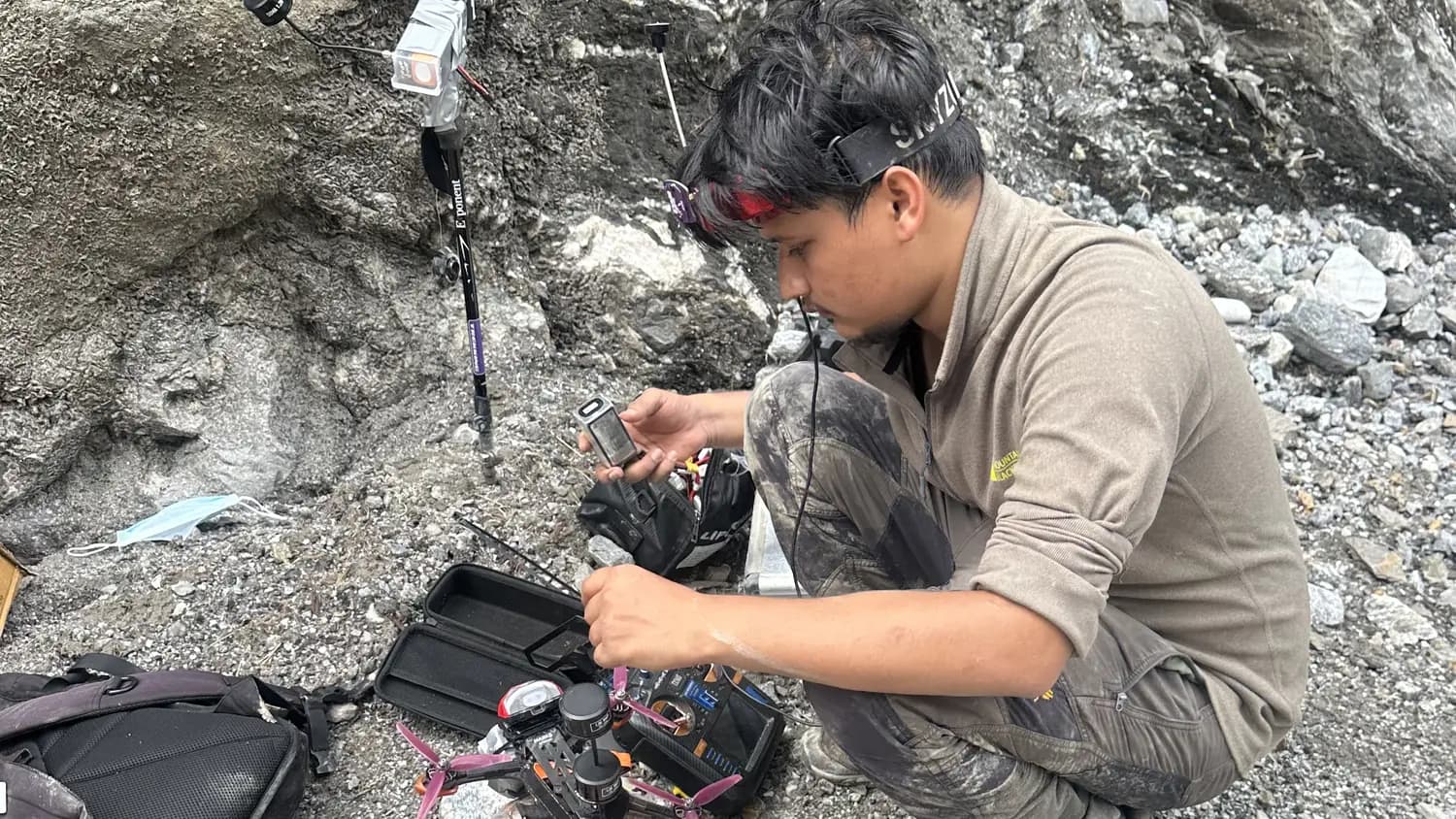
Adarsha outside the Upper Trishuli-1 tunnel, setting up the video relay and an FPV drone, August 2026

August 2026 · Nuwakot, Nepal

Into the Upper Trishuli-1 tunnel

Problem
After the August 2026 flood, rescuers needed eyes inside a flooded, debris-filled hydropower tunnel where radio video signals die at the first bend.
Built
Overnight, a relay that converts 5.8 GHz video to 1.2 GHz so the signal bends through wet concrete. Army special forces carried it in on a trekking stick.
Result
The drone reached the first debris platform before rockfall closed the way. The Nepal Army's follow-up mission confirmed what it showed.
to design and build the relay
1 night
tunnel length
~180 m
relay frequency
1.2 GHz
Read the full mission

August 2026 · Rasuwa, Nuwakot and Dhading

Reconnecting the Trishuli corridor

Problem
The flood cut communication lines, ropeways and power across the Trishuli and Bhote Koshi valleys.
Built
Drone line-stringing (a pilot wire flown across, then a bigger wire, then the real cable, with a custom drop mechanism) and drone delivery of relief materials.
Result
GarudX led the stringing work: a line and ropeway at the Chilime tunnel that sped up the rescue, and internet, electricity and a ropeway reconnected at Devighat for 150+ households.
longest span strung
1.3 km
households reconnected at Devighat
150+
a day moved by Nepal Army drones after GarudX's delivery training
3,000+ kg
Read the full mission

From the PCB up.

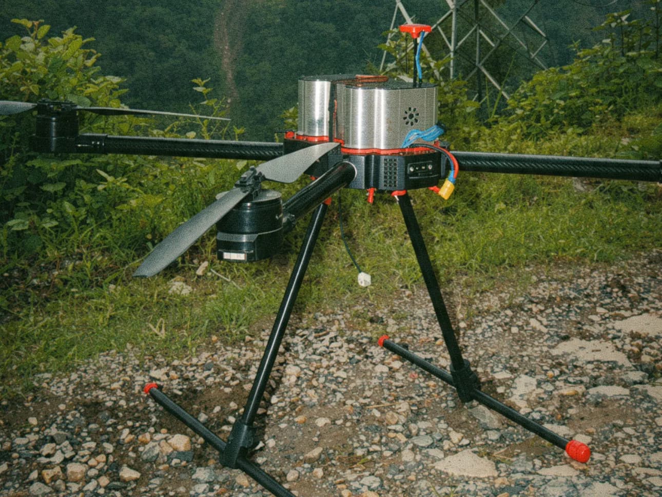
Every platform is designed, wired, powered and tuned in-house.

Airframes and CAD
Fusion 360 design, carbon fibre, CNC and 3D-printed parts.
Power systems
Custom 12S to 28S lithium-ion packs, BMS and tether power.
Avionics and RF
Pixhawk and ArduPilot integration, RF links and relays.
Electronics
PCB design, wiring architecture and companion computers.
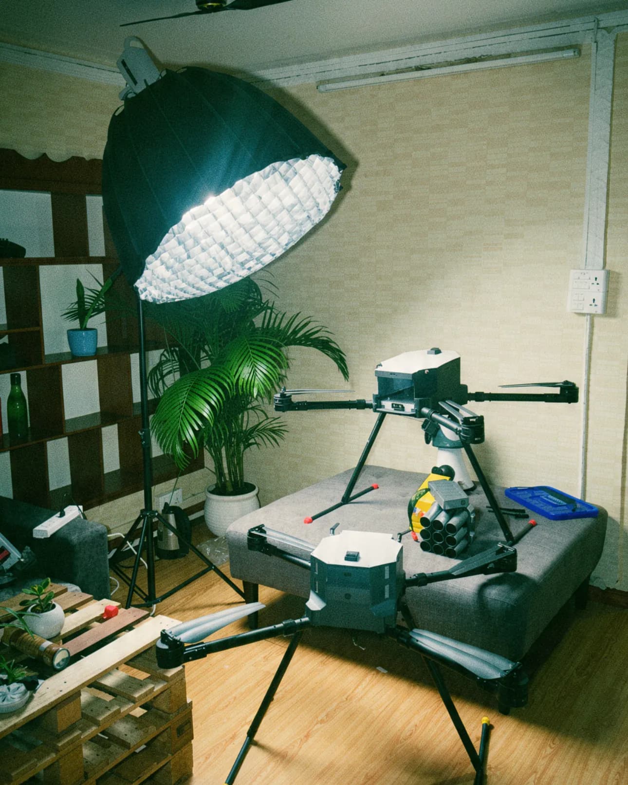
The GarudX studio: drones on stands and a heavy-lift drone under a softbox

The software that flies them.

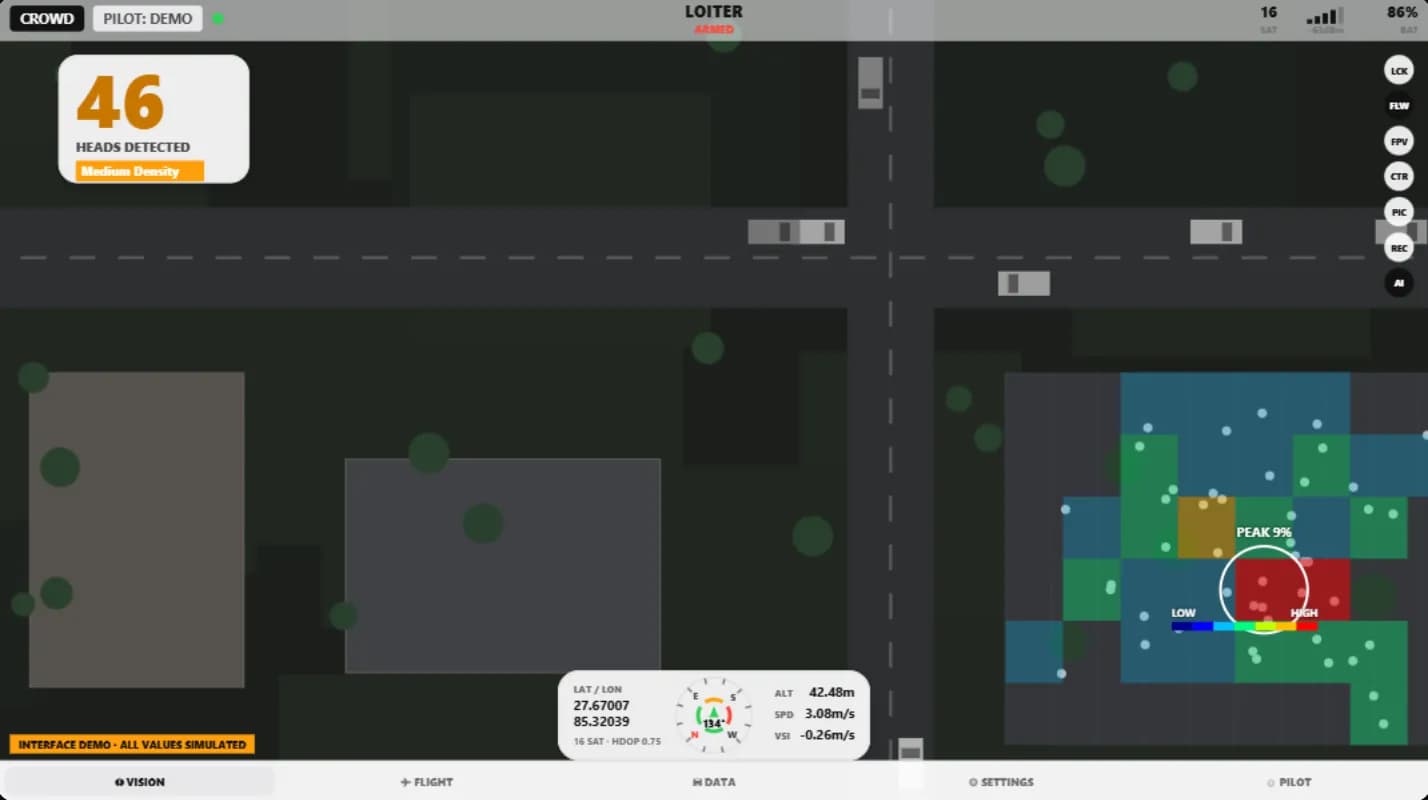
GarudX Tactical GCS runs on the SIYI MK32 controller and brings together live video, MAVLink telemetry, onboard AI detections and pilot flight logs in one interface. Nepal Police use it for search-and-rescue surveillance.

Tracking: Lock onto a target and the gimbal follows it. The crosshair turns green when the lock holds. Interface demonstration. The feed, detections and every value shown are simulated.

Interface demonstration. The feed, detections and every value shown are simulated.

Lock onto a target and the gimbal follows it. The crosshair turns green when the lock holds.

  1. 01Aircraft sensorsCameras and flight sensors on the airframe.
  2. 02Pi 5 + HailoEdge AI on board: plates, crowds, traffic.
  3. 03SIYI linkVideo and telemetry down to the ground.
  4. 04MK32 ground stationGarudX Tactical GCS on the pilot's controller.
  5. 05RTMP relayRestreams the feed off the field.
  6. 06Command postLive video where decisions get made.

Simplified and not to scale.

What I'm working on now.

  • Swarm flight

    Coordinated multi-drone flight for light shows and cooperative missions.

    Ongoing

  • GPS-denied navigation

    Localization for places satellites can't reach, like tunnels and deep valleys.

    Ongoing

  • Autonomous navigation

    Drones that plan and fly their own routes.

    Ongoing

  • Edge AI on board

    Number-plate recognition, crowd counting and traffic analysis on a Raspberry Pi 5 with a Hailo accelerator.

    Ongoing

  • ATLAX

    A relief-delivery drone for cut-off villages, still in development and not yet complete.

    R&D

All research

Recognised by people who check.

  • World Bank Drone Ecosystem Acceleration Program (DEAP), run in Nepal as Elevate Nepal with Impact Hub Kathmandu
  • NYEF Startup Award, first runner-up
  • US-Nepal Startup Weekend Challenge, winner (Feb 2026)
  • Film Development Board of Nepal: certified drone trainer

And before all of it, the camera.

Specialist FPV and cinelifter pilot for film, ads and music videos, with work in Dubai, China, India and Ladakh.

feature films
17+
ads and music videos
200+
countries: Nepal, India, China, UAE
4
Film work and VFX